
Table of Contents
Geography of Dehradun
Dehradun is one of the most beautiful and naturally rich districts of Uttarakhand. It is known for its peaceful valley, green surroundings, educational institutions, pleasant climate, rivers, forests, and close connection with the Himalayan region.
But Dehradun is not only a tourist destination. Its geography plays a major role in shaping its identity, lifestyle, climate, tourism, agriculture, and natural beauty. The city is located in the famous Doon Valley, between the Himalayan foothills and the Shivalik hills. This unique location gives Dehradun its valley landscape, mixed climate, forest cover, rivers, streams, fertile soil, and scenic environment.
In this guide, we will understand the geography of Dehradun in a simple question-answer format.
Where is Dehradun located?
Dehradun is located in the northern part of India in the state of Uttarakhand. It is the capital city of Uttarakhand and also the headquarters of Dehradun district.
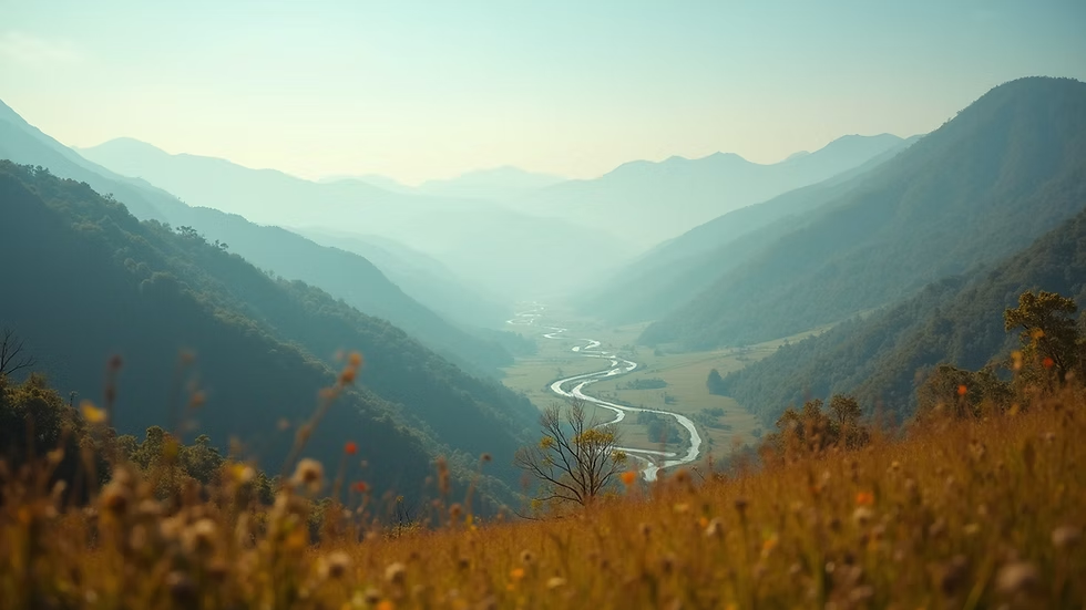
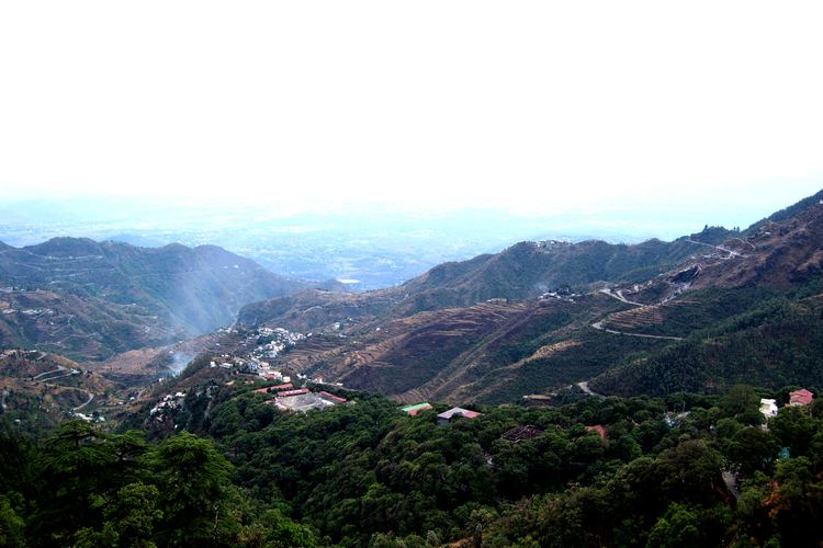
Geographically, Dehradun lies in the Doon Valley. This valley is located between the lower Himalayan ranges in the north and the Shivalik hills in the south. Because of this location, Dehradun has a natural valley structure surrounded by hills, forests, rivers, and seasonal streams.
Dehradun is also well connected with nearby places such as Mussoorie, Rishikesh, Haridwar, Doiwala, Vikasnagar, Sahastradhara, Rajpur Road, Chakrata, and Clement Town.
Due to its location, Dehradun also works as a gateway to many important destinations in Garhwal, including Mussoorie, Yamunotri, Gangotri, Rishikesh, and other Himalayan routes.
What is the meaning of the word “Dehradun”?
The name “Dehradun” is commonly understood as a combination of two words: “Dehra” and “Dun.”
“Dehra” is often linked with a settlement, camp, or place of stay. “Dun” means a valley, especially a valley located between mountain ranges.
So, Dehradun can be understood as a settlement in a valley. This meaning matches the geography of the region very well because Dehradun is located in the famous Doon Valley.
Why is Dehradun called a valley city?
Dehradun is called a valley city because it lies in the Doon Valley. A valley is a low area of land between hills or mountains.
The Doon Valley is located between two major physical features: the Lesser Himalayas or Mussoorie range in the north, and the Shivalik hills in the south.
This natural setting gives Dehradun a bowl-like valley structure. The city is surrounded by hills, forests, streams, and open plains. This is why Dehradun feels different from flat plain cities like Delhi or Meerut and hill towns like Mussoorie or Nainital.
Dehradun has a mixed geographical character. It is partly plain, partly foothill, and partly mountainous.
What is the total area of Dehradun district?
Dehradun district covers an area of about 3,088 square kilometres.
This area includes urban spaces, rural villages, forests, agricultural land, rivers, foothills, and hilly regions. The geography of the district is not the same everywhere. Some areas are flat and urban, some are agricultural, and some are mountainous.
For example: Dehradun city has urban and semi-urban geography. Doiwala has agricultural and forest-edge geography. Rajpur and Sahastradhara are closer to hill slopes. Chakrata and Jaunsar-Bawar have mountain geography. Rishikesh side connects with river and foothill geography.
This diversity makes Dehradun one of the most geographically interesting districts of Uttarakhand.
What is the altitude of Dehradun?
Dehradun city is located at an altitude of around 640 metres above sea level.
This altitude is one of the main reasons behind Dehradun’s pleasant weather compared to the hot plains of North India. It is not as cold as high hill stations, but it is usually cooler than many plain cities.
However, the altitude changes across the district. Areas near Mussoorie, Chakrata, and other hilly regions are higher, while areas closer to the plains are lower. Due to this altitude variation, different parts of Dehradun district experience different weather conditions.
What are the main physical features of Dehradun?
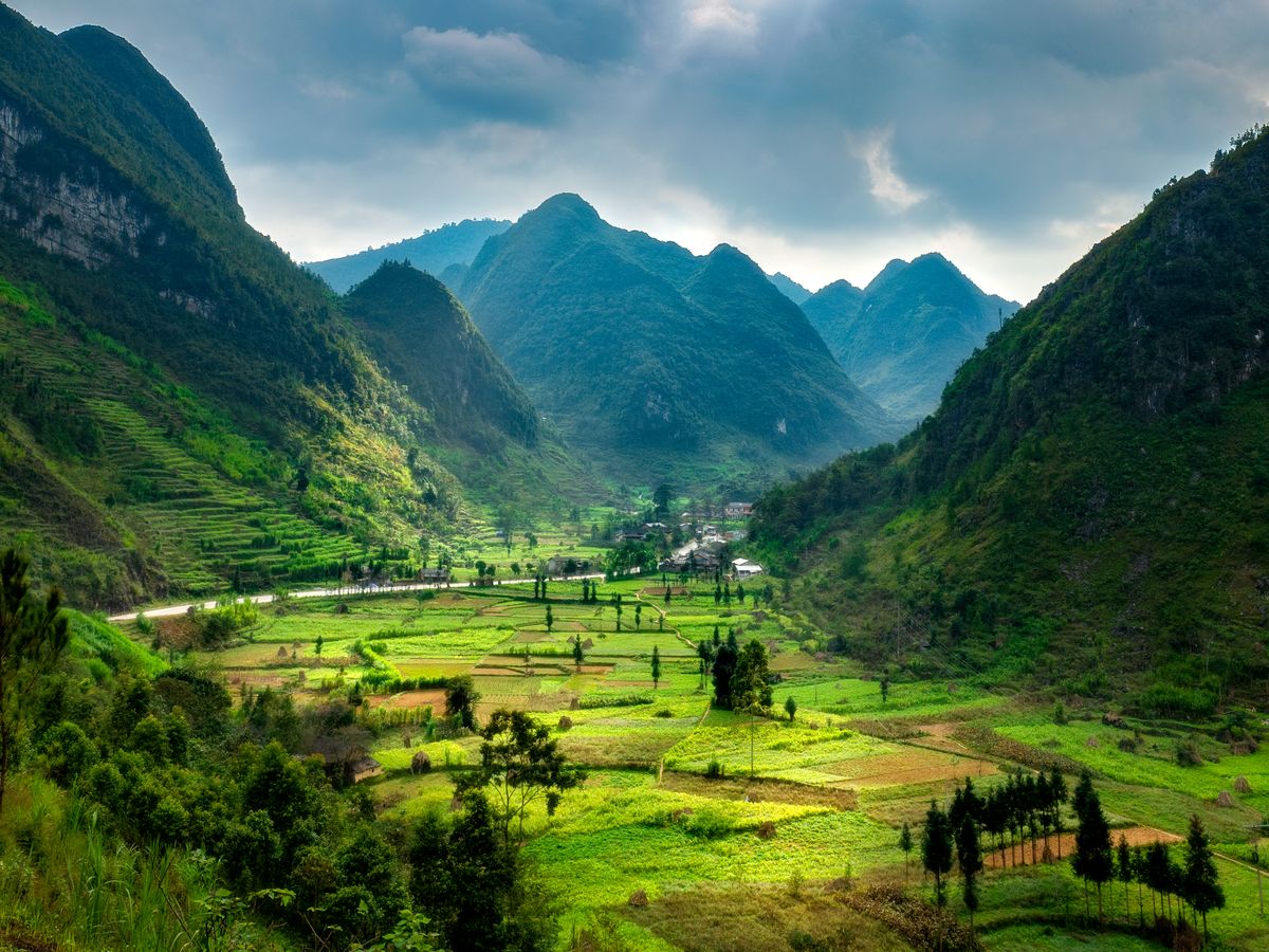
The geography of Dehradun includes many physical features. The most important ones are: Doon Valley, Shivalik hills, Lesser Himalayan foothills, rivers and seasonal streams, forests, agricultural plains, urban settlements, mountain slopes, natural springs, and river terraces and floodplains.
These physical features make Dehradun a combination of nature, urban growth, agriculture, tourism, and ecological importance.
Dehradun is not only a city area. The district includes villages, forests, hills, valleys, and river systems. That is why Dehradun’s geography is important for students, travellers, researchers, environmentalists, and local residents.
Which mountain ranges surround Dehradun?
Dehradun is mainly surrounded by the Himalayan foothills and the Shivalik range.
To the north, the Mussoorie range and the lower Himalayan region form a natural boundary. To the south, the Shivalik hills separate the valley from the plains.
This location gives Dehradun a protected valley structure. It also influences the region’s weather, rainfall, water flow, vegetation, and settlement pattern.
Areas such as Rajpur Road, Mussoorie Road, Sahastradhara, and Maldevta clearly show the transition from city landscape to hill landscape.
What is the Doon Valley?
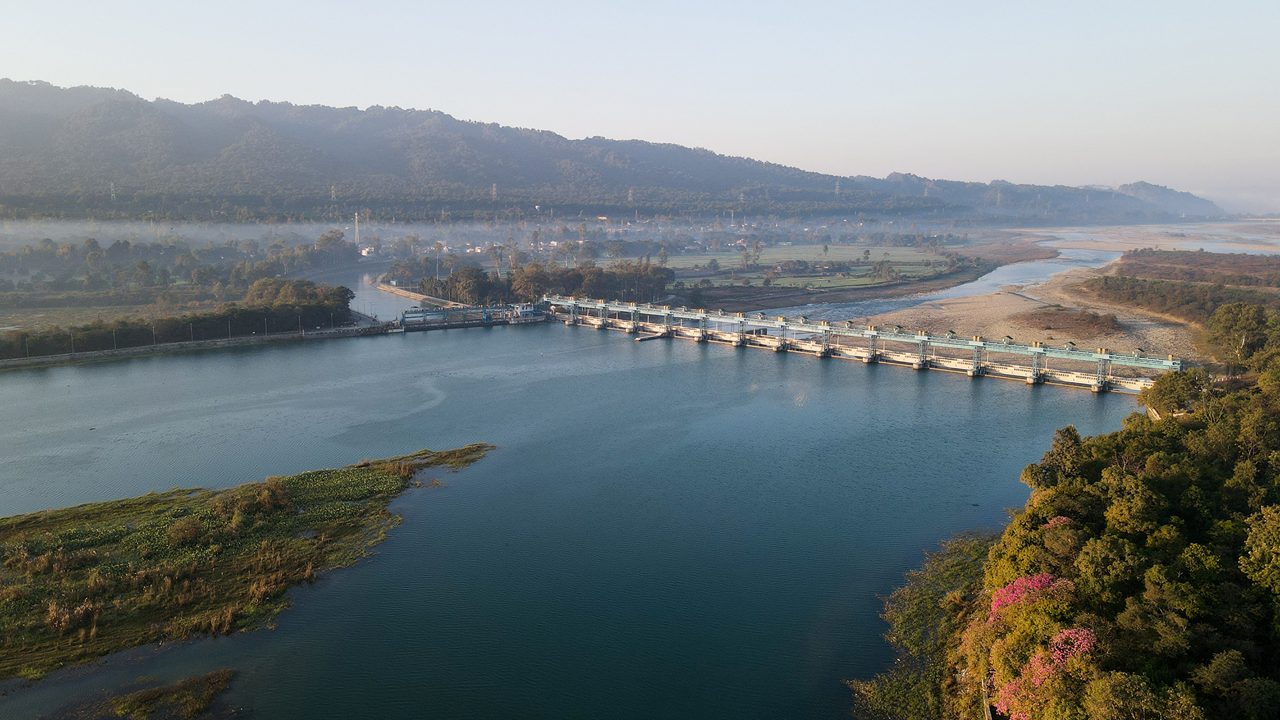
The Doon Valley is a valley region located between the Shivalik hills and the lower Himalayas. Dehradun is the most famous city in this valley.
The word “Dun” itself refers to a valley. The Doon Valley is known for its greenery, moderate climate, fertile soil, streams, and scenic surroundings.
The valley supports urban settlement, agriculture, forest cover, tourism, educational institutions, water resources, and biodiversity.
The geography of Dehradun cannot be understood without understanding the Doon Valley because the city’s identity is directly connected with this valley.
Why is the Doon Valley important?
The Doon Valley is important for many reasons. First, it provides a natural settlement area between the mountains and the plains, which made Dehradun suitable for human settlement, education institutions, markets, and administrative development.
Second, the valley has fertile land, which helped agriculture, orchards, and plantation activities grow in and around Dehradun.
Third, the valley has rich natural beauty. The presence of hills, forests, rivers, streams, and seasonal waterfalls makes Dehradun attractive for tourism.
Fourth, the valley has ecological importance — forests, water bodies, and natural drainage systems help maintain environmental balance.
Fifth, the valley works as a gateway to the Garhwal Himalayas. Travellers moving towards Mussoorie, Rishikesh, Tehri, Yamunotri, Gangotri, and other Himalayan routes often pass through Dehradun. If you’re planning a trip through the region, our complete Dehradun travel guide covers the major routes and stops.
Which rivers flow through Dehradun?
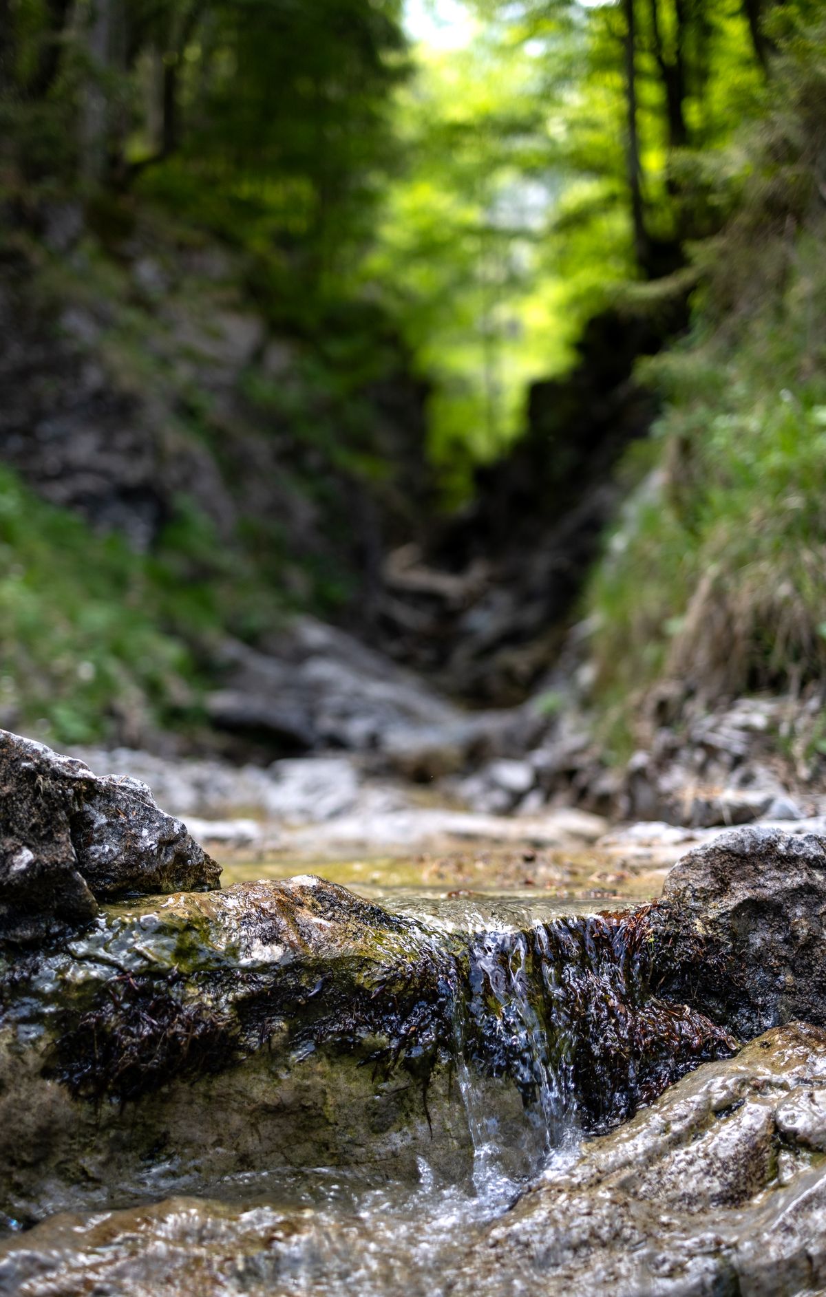
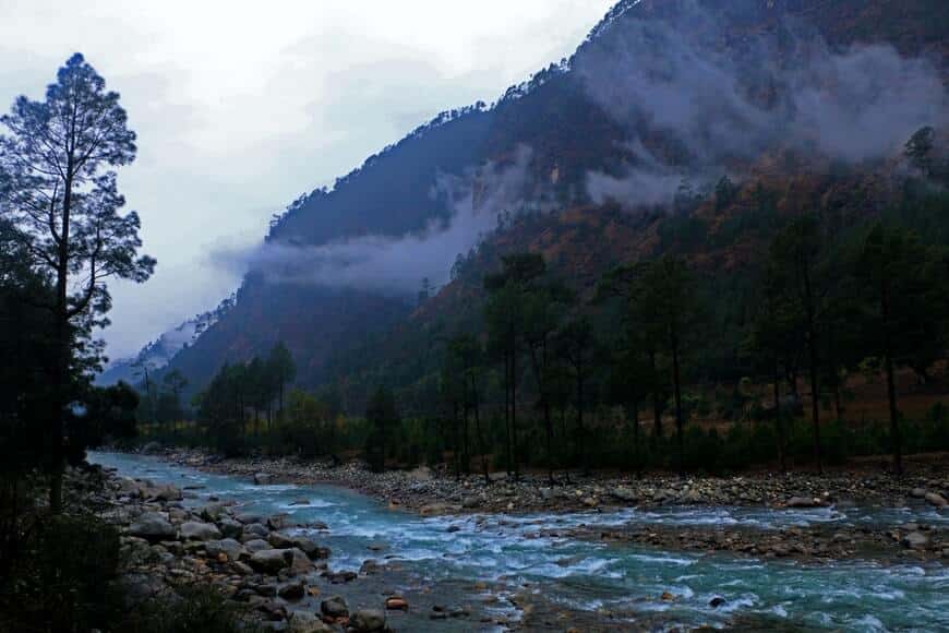
Dehradun district has several rivers, streams, and seasonal water channels. Some important rivers and streams associated with the district include the Song River, Asan River, Rispana River, Bindal River, Suswa River, the Tons River in the western region, the Yamuna river system around the western side, and the Ganga river system towards the eastern side near Rishikesh and Haridwar.
Rivers and streams are important for the geography of Dehradun because they shape the land, support agriculture, recharge groundwater, and influence settlement patterns.
However, urban growth and pollution have created pressure on some local rivers and streams, especially in city areas. Clean rivers are important for Dehradun’s future because water bodies are directly connected with flood control, groundwater recharge, ecology, and public health.
What type of climate does Dehradun have?
Dehradun has a generally pleasant climate, but it changes according to altitude and season. The city experiences a summer season, a monsoon season, a winter season, and spring-like transition periods.
Summers can be warm, especially in the main city and valley areas. Monsoon brings heavy rainfall, greenery, humidity, and sometimes waterlogging or landslide risk in hilly areas. Winters are cool and pleasant in the city, while higher regions of the district can become much colder.
Because Dehradun has both valley and hilly areas, the climate is not uniform everywhere. Higher areas are cooler, while lower valley areas can be warmer.

What is the summer season like in Dehradun?
Summer in Dehradun usually starts around March and continues till June. During this time, the city can become warm, especially in April, May, and June.
However, Dehradun is still more comfortable than many plain cities because of its elevation and surrounding hills. Early mornings and evenings can be pleasant in many areas.
Popular summer spots around Dehradun include Sahastradhara, Robber’s Cave, Maldevta, Lachhiwala, Mussoorie Road, the Rajpur area, and the Forest Research Institute surroundings. We’ve covered these in more detail in our guide to best summer destinations in Dehradun.
Geography plays a big role in Dehradun’s summer experience. Streams, hills, shaded roads, forest patches, and nearby hill stations give people natural relief from the heat.
What is the monsoon season like in Dehradun?
Monsoon is one of the most important seasons in Dehradun’s geography. It usually brings heavy rainfall, lush greenery, flowing streams, cloudy weather, and cooler temperatures.
During monsoon, places like Sahastradhara, Maldevta, Robber’s Cave, and hill roads become very beautiful. But the same season also brings some risks, such as waterlogging, landslides on hill roads, slippery roads, flash flood risk near streams, drainage problems in urban areas, mosquito-related health concerns, and riverbank erosion.
This is why monsoon travel in Dehradun should be planned carefully. People should avoid entering strong water streams during heavy rain and should follow local weather alerts. For a full seasonal breakdown, see our monsoon in Dehradun guide.
What is winter like in Dehradun?
Winter in Dehradun usually starts around November and continues till February. The city becomes cool, calm, and comfortable. Mornings and nights can be cold, while afternoons are usually pleasant.
Higher places near Mussoorie, Chakrata, and other hill regions become much colder than the city. Sometimes tourists stay in Dehradun and travel to nearby hill areas to enjoy winter views.
Winter is also a good season for sightseeing because the weather remains clear and comfortable for travel.
How does altitude affect Dehradun’s weather?
Altitude affects temperature, rainfall, vegetation, and daily weather experience.
In Dehradun district, lower areas are warmer, while higher areas are cooler. This is why Dehradun city may feel warm in summer, but Mussoorie Road or Chakrata side may feel cooler.
Altitude also affects vegetation. Higher regions support different types of forests and plants compared to lower valley areas. This altitude variation is one reason why Dehradun district has diverse landscapes within a relatively small area.
What kind of soil is found in Dehradun?
Dehradun has different soil types because of its varied geography. The valley and river areas have fertile alluvial soil, while hilly areas have soil influenced by slopes, rocks, forests, and erosion.
The fertile soil of the valley supports agriculture, orchards, gardens, and plantations. In many parts of Dehradun, soil and climate together support crops, fruits, vegetables, and forest vegetation.
However, soil erosion can be a problem in hilly and riverbank areas, especially during heavy rainfall. Urban construction, deforestation, and poor drainage can increase this risk.
What crops and vegetation are common in Dehradun?
Dehradun’s geography supports both agriculture and natural vegetation. Common agricultural and vegetation features include rice cultivation in suitable areas, wheat cultivation, pulses and vegetables, litchi orchards, mango trees, forest trees, Sal forests in lower areas, pine and mixed vegetation in higher areas, and medicinal plants in some forest regions.
Dehradun was once widely known for basmati rice and litchi. The fertile valley land and suitable climate helped these crops and fruits grow well.
Today, urban expansion has reduced agricultural land in many areas, but agriculture still remains important in parts of the district.
Why is Dehradun famous for litchi and basmati rice?
Dehradun’s climate, soil, and valley conditions made it suitable for litchi and basmati rice.
Litchi needs a suitable combination of temperature, moisture, and soil conditions. Dehradun’s valley climate has historically supported good litchi production.
Similarly, the valley’s fertile soil and water availability helped basmati cultivation in the past. However, with growing urbanisation, real estate development, and land-use change, agricultural areas have reduced in many parts of Dehradun. This has affected traditional farming patterns.
What type of forests are found in Dehradun?
Dehradun district has rich forest cover in many areas. The forests vary according to altitude, rainfall, and slope.
Common forest types and vegetation zones include Sal forests in lower regions, mixed deciduous forests, pine forests in higher areas, riverine vegetation near streams, shrubs and grassland patches, and forest areas around the Rajaji landscape and nearby zones.
Forests are important for Dehradun because they help in maintaining rainfall balance, preventing soil erosion, recharging groundwater, supporting wildlife, cooling the local climate, improving air quality, and supporting tourism and recreation. Green cover is one of Dehradun’s strongest natural assets.
What wildlife is found around Dehradun?
Dehradun and its surrounding forest areas support rich biodiversity. The district is close to important forest landscapes and wildlife zones.
Wildlife around Dehradun may include elephants in forest corridors, leopards in forested and hilly areas, deer species, monkeys and langurs, birds, reptiles, small mammals, and aquatic life in rivers and streams.
Rajaji National Park, forest corridors, and hill forests make the region ecologically important. However, urban expansion has increased human-wildlife interaction in some areas. This makes forest conservation and responsible development very important for Dehradun.
What are the major natural tourist places related to Dehradun’s geography?
Many tourist places in Dehradun are directly connected with its geography.
Sahastradhara is known for natural springs, streams, caves, and limestone formations. Its geography makes it one of the most famous water-based attractions near Dehradun.
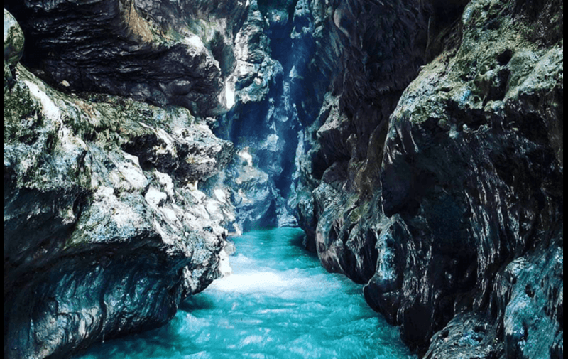
Robber’s Cave, also called Gucchupani, is a natural cave formation where a stream flows through a narrow rocky passage. It is a strong example of Dehradun’s geological beauty.
Maldevta is known for hills, streams, open landscapes, and monsoon beauty. It attracts people who enjoy nature, photography, and peaceful surroundings.
Lachhiwala is known for forest surroundings, picnic spots, and natural water areas.
Mussoorie Road shows the transition from Dehradun valley to hill terrain, with slopes, viewpoints, forests, and changing weather.
Forest Research Institute area is not only architecturally beautiful but also connected with Dehradun’s forest identity and environmental studies. For a complete list of spots, check our guide to top tourist places in Dehradun.
How does Dehradun’s geography affect tourism?
Dehradun’s geography is one of the biggest reasons behind its tourism growth. The city offers valley views, nearby hill stations, waterfalls and streams, caves, forests, rivers, pleasant weather, mountain roads, nature photography spots, adventure routes, and spiritual travel connections.
Tourists can enjoy both city comfort and natural attractions. This combination makes Dehradun different from purely urban destinations and purely hill destinations.
Because of its central location, Dehradun also works as a base for trips to Mussoorie, Rishikesh, Haridwar, Chakrata, Dhanaulti, Tehri, and Char Dham routes. For a full list of activities, see things to do in Dehradun.
How does geography affect lifestyle in Dehradun?
Geography strongly affects the lifestyle of Dehradun. People in Dehradun enjoy relatively pleasant weather, easy access to hills, natural picnic spots, forest surroundings, cleaner air in many areas, local fruits and seasonal food, outdoor activities, and travel opportunities.
At the same time, geography also creates challenges such as traffic pressure in narrow valley roads, waterlogging during monsoon, landslide risk on hill roads, river pollution in urban areas, pressure on green cover, urban heat in crowded zones, and drainage issues in expanding colonies.
So, Dehradun’s geography gives comfort and beauty, but it also needs careful planning and protection.
Why is Dehradun important from an environmental point of view?
Dehradun is environmentally important because it connects the plains with the Himalayan region. It has forests, rivers, hills, biodiversity, groundwater zones, and sensitive natural landscapes.
The district plays an important role in water recharge, forest conservation, wildlife movement, river health, climate balance, soil protection, tourism ecology, and the Himalayan foothill environment.
If Dehradun’s natural systems are damaged, the impact can be seen in flooding, pollution, heat, water shortage, and biodiversity loss. That is why sustainable development is very important for Dehradun.
What are the main environmental challenges in Dehradun?
Dehradun faces several environmental challenges because of rapid urban growth. Major challenges include loss of green cover, river pollution, unplanned construction, traffic congestion, air pollution in busy areas, waterlogging during monsoon, pressure on groundwater, waste management issues, encroachment near natural drains, and landslide and erosion risk in hilly areas.
These problems are not only environmental issues. They affect daily life, tourism, public health, and future development.
Why does Dehradun face waterlogging during monsoon?
Waterlogging happens when rainwater cannot drain properly. In Dehradun, this problem can occur because of heavy monsoon rainfall, blocked drains, construction on natural drainage paths, poor urban planning, reduced open land, encroachment near streams, and rapid concrete development.
Earlier, many natural drains and seasonal channels helped rainwater flow out of the city. But with urban expansion, some of these natural paths have been disturbed.
To reduce waterlogging, Dehradun needs better drainage planning, protection of natural water channels, and responsible construction.
How has urbanisation changed Dehradun’s geography?
Urbanisation has changed Dehradun in many ways. Earlier, Dehradun had more open land, orchards, farms, and forest-edge settlements. Today, many areas have become residential colonies, commercial markets, roads, hotels, institutions, and urban zones.
Urbanisation has brought development, jobs, education, tourism, and better connectivity. But it has also created pressure on green cover, water resources, local rivers, traffic systems, agricultural land, natural drainage, air quality, and waste management.
The challenge is not development itself. The real challenge is unplanned development. Dehradun needs balanced growth where city expansion does not destroy the natural geography that makes the city special.
What is the role of rivers in Dehradun’s geography?
Rivers and streams are very important in Dehradun’s geography. They help in draining rainwater, recharging groundwater, supporting agriculture, creating fertile floodplains, supporting biodiversity, maintaining ecological balance, and shaping the land.
Local rivers and streams also have cultural and historical value. But pollution, waste dumping, sewage, and encroachment can damage them. Healthy rivers are important for a healthy Dehradun.
How does Dehradun connect the plains and the Himalayas?
Dehradun is located between the northern Indian plains and the Garhwal Himalayas. This gives it a special geographical position.
From Dehradun, one can travel towards Haridwar and the plains, Rishikesh and the Ganga valley, Mussoorie and the hill region, Chakrata and western Garhwal, Yamunotri and Gangotri routes, and Tehri and higher Himalayan areas.
Because of this, Dehradun works as a transition zone. It has features of both plains and hills. This is one reason why Dehradun is important for travel, administration, education, defence, tourism, and regional connectivity.
What makes Dehradun’s geography unique?
Dehradun’s geography is unique because it combines many natural features in one place: a valley landscape, Himalayan foothills, Shivalik hills, rivers and streams, forests, agricultural areas, urban settlements, natural caves, waterfalls and springs, mountain roads, pleasant climate, and biodiversity.
Very few cities in India offer this kind of geographical variety. Dehradun is not only a city; it is a valley ecosystem. Its natural beauty, climate, location, and landscape make it one of the most attractive places in North India. For more on the city’s roots, read our history of Dehradun.
Quick Geography Facts About Dehradun
| Feature | Details |
|---|---|
| State | Uttarakhand |
| Region | Garhwal |
| District Headquarters | Dehradun city |
| Location Type | Valley city |
| Valley | Doon Valley |
| Main Hill Systems | Lesser Himalayas and Shivalik hills |
| Approximate Altitude | Around 640 metres above sea level |
| District Area | Around 3,088 sq km |
| Climate Type | Generally pleasant, varies by altitude |
| Major Nearby Places | Mussoorie, Rishikesh, Haridwar, Chakrata, Doiwala |
| Important Natural Features | Rivers, forests, springs, caves, hills, valley plains |
Why should students study the geography of Dehradun?
Students should study the geography of Dehradun because it helps them understand how valleys are formed, how altitude affects climate, how rivers shape land, how forests support ecology, how urbanisation changes natural landscapes, how tourism depends on geography, how Himalayan foothill cities develop, and how environmental challenges affect daily life.
For school projects, exams, travel writing, and general knowledge, Dehradun is a very useful case study.
Why should travellers understand Dehradun’s geography?
Travellers should understand Dehradun’s geography because it helps them plan better trips. Monsoon travel needs caution near rivers and hill roads. Summer trips are better near streams and forest areas. Winter is good for city sightseeing and nearby hill travel. Hill routes require careful driving. Natural spots should be visited responsibly, and weather can change quickly near higher areas.
A basic understanding of geography makes travel safer and more enjoyable.
Why does Dehradun’s geography matter for the future?
Dehradun’s future depends on how well it protects its geography. If the city protects its rivers, forests, hills, and natural drainage, it can grow as a beautiful and sustainable capital city. But if development ignores natural systems, the city may face more flooding, heat, pollution, traffic, and water stress.
The best future for Dehradun is balanced development. This means protecting rivers, saving forests, controlling unplanned construction, improving drainage, promoting eco-friendly tourism, using land carefully, keeping hill slopes safe, reducing pollution, and respecting natural geography.
Dehradun’s identity is its nature. Protecting that nature is the responsibility of residents, tourists, businesses, and authorities.
FAQs About the Geography of Dehradun
What is the geography of Dehradun?
The geography of Dehradun includes the Doon Valley, Himalayan foothills, Shivalik hills, rivers, streams, forests, agricultural land, and urban settlements.
Where is Dehradun located?
Dehradun is located in Uttarakhand, India. It lies in the Doon Valley between the Shivalik hills and the lower Himalayan ranges.
Why is Dehradun called a valley?
Dehradun is called a valley because it is located in the Doon Valley, a lowland area between the Shivalik hills and the Himalayan foothills.
What is the altitude of Dehradun?
Dehradun city is located at an altitude of around 640 metres above sea level.
What type of climate does Dehradun have?
Dehradun has a generally pleasant climate, but it changes with altitude. Summers can be warm, monsoons are rainy, and winters are cool.
Which rivers are found in Dehradun?
Important rivers and streams linked with Dehradun include Song, Asan, Rispana, Bindal, Suswa, Tons, and nearby Ganga and Yamuna river systems.
Which hills surround Dehradun?
Dehradun is surrounded by the lower Himalayan ranges in the north and the Shivalik hills in the south.
Why is Dehradun important geographically?
Dehradun is important because it connects the plains with the Himalayan region. It has forests, rivers, valley land, tourism spots, and ecological importance.
What are the main natural attractions in Dehradun?
The main natural attractions include Sahastradhara, Robber’s Cave, Maldevta, Lachhiwala, Mussoorie Road, the Rajpur area, and forest surroundings.
What are the environmental problems in Dehradun?
The main environmental problems include river pollution, unplanned construction, loss of green cover, traffic pressure, waterlogging, and pressure on natural drainage systems.
Conclusion
The geography of Dehradun is the main reason behind its beauty, climate, lifestyle, tourism, and importance. Its location in the Doon Valley, surrounded by the Himalayan foothills and Shivalik hills, gives it a unique natural identity.
Dehradun has rivers, forests, fertile land, springs, caves, hill roads, and a pleasant climate. At the same time, rapid urbanisation has created challenges for the city’s natural systems.
To understand Dehradun properly, we must look beyond roads, markets, and buildings. We must understand its valley, rivers, forests, hills, climate, and environment.
Dehradun is not just a city in Uttarakhand. It is a living valley ecosystem, and its geography is the heart of its identity.
Last updated: June 30, 2026